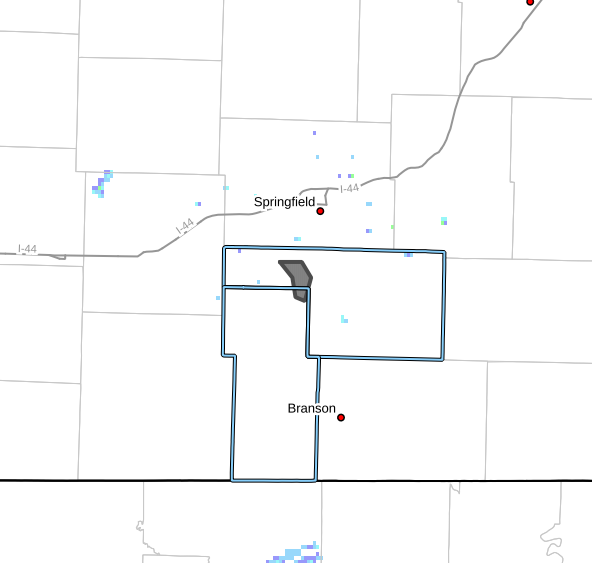
The National Weather Service issued several Severe Thunderstorm Warnings across the Ozarks this morning.
Commander Tom took the above photo of the storm line in Springfield.
There have been reports of hail from the size of peas to baseballs, 60-70 mile per hour winds and several inches of rain.
The heaviest rain so far hitting Conway, Marshfield, Fordland Sparta and south of Highlandville.
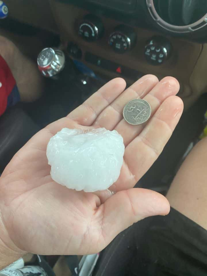
This baseball size was picked up just south of Hollister.
There have also been reports of large, golfball size hail at the School of the Ozarks in Point Lookout, Mo.
We have reports of tree and roof damage in the Humansville area, nickel size hail in Diggins and dime size hail out of Saddlebrook and Chestnut Ridge.
Your KTTS Storm Chasers will be following this watch throughout the day, tune in to 94.7 for updates.
More strong to severe thunderstorms are expected tomorrow afternoon and evening.