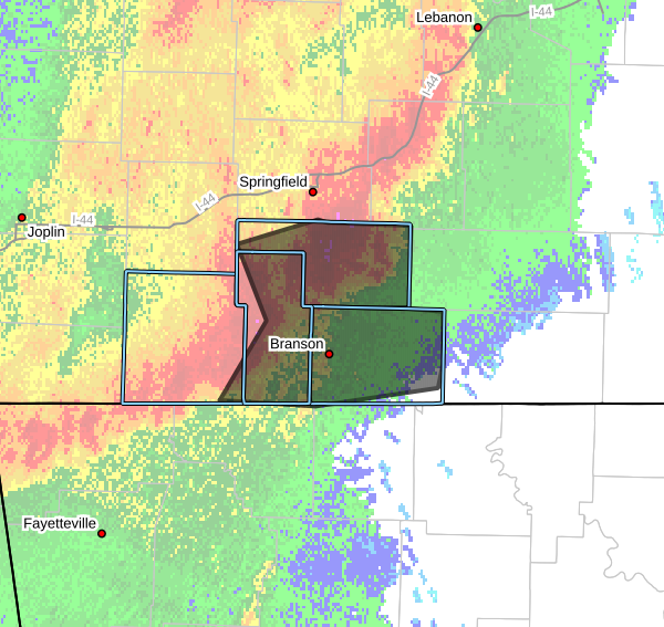
The National Weather Service in Springfield has issued a Severe Thunderstorm Warning for Taney County, Christian County , Stone County and Southeastern Barry County until 230 AM CDT.
* At 135 AM CDT, severe thunderstorms were located along a line extending from near Clever to near Galena to 7 miles north of Grandview, moving east at 50 mph.
HAZARD…60 mph wind gusts and penny size hail.
SOURCE…Radar indicated.
IMPACT…Expect damage to roofs, siding, and trees.
* Locations impacted include…Nixa, Ozark, Branson, Lake Taneycomo, Table Rock Lake, Bull Shoals Lake, Table Rock State Park, Shepherd of the Hills State Park, Hollister, Silver Dollar City, Kimberling City, Forsyth, Clever, Merriam Woods, Sparta, Shell Knob, Kissee Mills, Reeds Spring, Highlandville, and Rockaway Beach.
PRECAUTIONARY/PREPAREDNESS ACTIONS…
For your protection move to an interior room on the lowest floor of a building.
A Tornado Watch remains in effect until 400 AM CDT for southwestern Missouri.


